Applications
Calian antennas cater to diverse applications, with a commitment to adaptability and personalized solutions.
Connecting possibilities, tailoring solutions.
Calian’s antennas are being used in a wide variety of applications and are being evaluated for new and sometimes novel applications
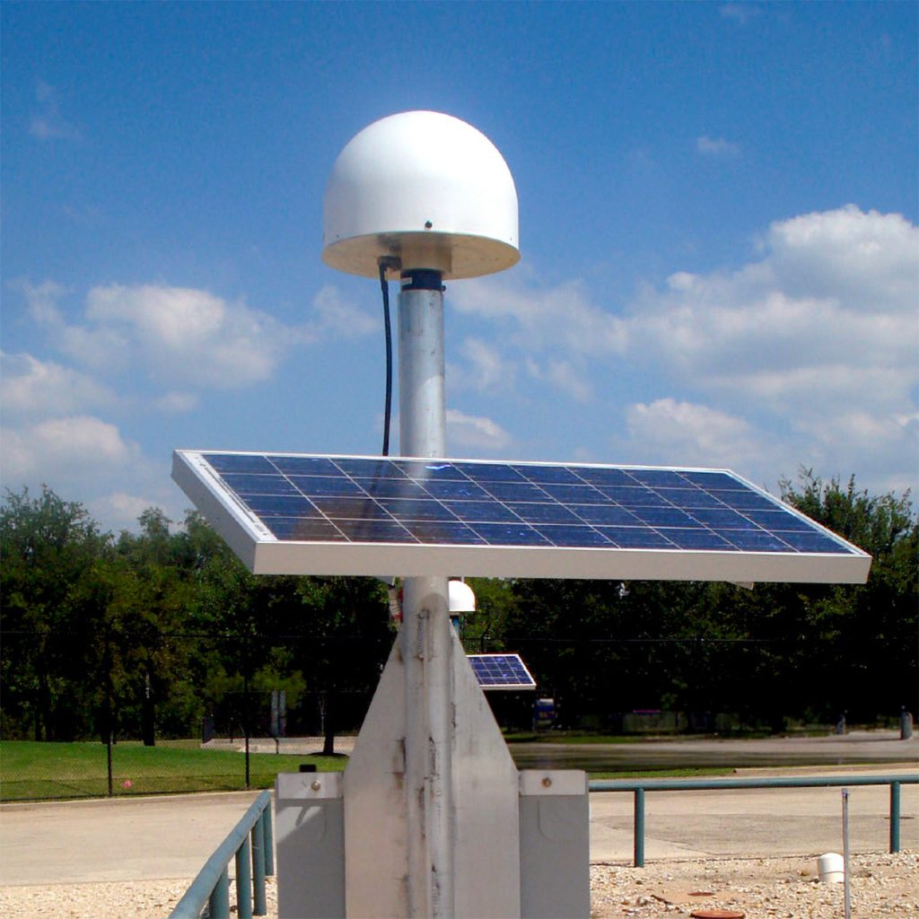
Geodetic Reference Networks
When precision matters.
Enhance your geodetic projects with our precision antennas, designed for accurate GNSS monitoring and optimal RTK/PPP application support.

Timing
Precisely the right antenna.
Calian offers a range of reliable, accurate and affordable antenna options and accessories for any Global Navigation Satellite System (GNSS) timing application including communications systems, electrical power grids and financial networks.

Iridium satellite communications
The Iridium satellite communication system provides global voice and data services. Iridium satellites orbit the earth at an inclination angle of 86.4° and an altitude of 781 km (Low Earth Orbit), providing pole to pole coverage. Iridium satellites broadcast and receive signals in the L-band spectrum. Calian offers a range of economical, high performance, Iridium-certified antennas.

Unmanned Aerial Vehicles (UAV)
Unmanned Aerial Vehicles have historically been primarily a military tool, however, it has now evolved into other innovative areas such as surveillance, infrastructure inspection, and package delivery with important tasks, such as remote sensing via aerial photography, digital elevation modelling.

Autonomous vehicles
Unmanned and autonomous land and sea vehicles are an emerging field that has the potential to revolutionize transportation systems.

Rail
Positive Train Control (PTC) and Positive Train Location (PTL) is taking advantage of the precision of GNSS systems. GNSS provides the ability to determine the speed of travel, which track it is on, and the direction a train is oriented even while stopped.

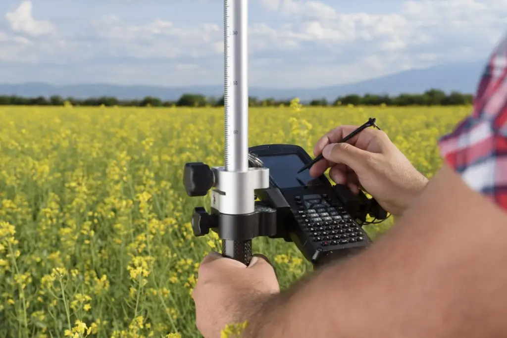
Precision agriculture
Precision agriculture has enabled farms to continue to improve crop yields and at the same time minimize the application of fertilizer, herbicides and pesticides. This also minimizes the effect on the environment and improves profit.

Marine
GNSS has significantly altered and improved Maritime operations. GNSS is used as a source of positioning, navigation, and timing data, (PNT) for a broad range of maritime applications. Marine applications also often require GNSS correction services to enable Precise Point Positioning (PPP) services, which are often in the L-band which is broadcast just below the GPS L1 band.

Navigation and orientation
Global navigation satellite systems (GNSS) provide three primary functions: position, navigation and time (PNT). GNSS signals enable users to estimate the position of the satellite at broadcast time and measure the distance from each satellite to determine the antenna’s position.

Passive antennas
To ensure reliable GNSS signal reception for emergency and service vehicles parked indoors, GNSS repeater systems use passive antennas to capture and rebroadcast signals, enabling instant navigation system operation during emergency calls.

Wearables
Personal tracking and sports performance measurement, real time or not, requires high precision, light weight, reliable, GNSS antennas. Calian’s antennas are used to provide this reliability and accuracy to many professional and amateur athletes.
Survey
Survey positioning combines Real-Time Kinematic (RTK), using a base station to guide a rover, and Precise Point Positioning (PPP) for direct position determination of survey objects.
Loading…
Talk to a Calian expert today
Reach out to learn how our innovative solutions can help you solve your most complex challenges.
Loading…